Another folksy, woodsy article. Why? Because I felt like passing along some arcane knowledge.
Alright, it’s been my experience that people are afraid of the common woodsman’s tool, the compass. I don’t know why. So today I want to do a quick and dirty bit about common sense compass use.
Look, it’s kind of a big deal to be able to figure out where you are and how to get to where you want to go. I know, cell phones have an app for this, right? And what about GPS?
Too much technology, and always have a backup. I enjoy “Bitchin’ Betty” on an iPhone just as much as anyone, and it’s nice to have a precise ten-digit grid when you are utterly lost. But who says you’ll always have that stuff? No one, really. So learn a little about a compass.
First, a few basics. I’ll point them out.
You should always be able to find the cardinal directions by simply observing the sun. The sun rises in the east, and sets in the west. In the northern hemisphere, it tracks across the southern sky. South of the equator, the opposite.
What does this mean. Here is an example.
In Virginia, you face the rising, morning sun. You are facing east. Your left arm points approximately north, your right arm points south. Your back is to the west.
Just like that, you know your cardinal directions.
At night, in the northern hemisphere, find Orion. South. Look the opposite direction for the Big Dipper. Roughly north. Polaris, or the north star, is close by.
How useful is this stuff? It can be a life saver. For example, generations of runaway slaves navigated from the Deep South to the North using nothing but the above: a journey of a thousand miles. Talk about courage and resourcefulness, along with a pinch of fieldcraft.
Alright, now let’s up our game a little.
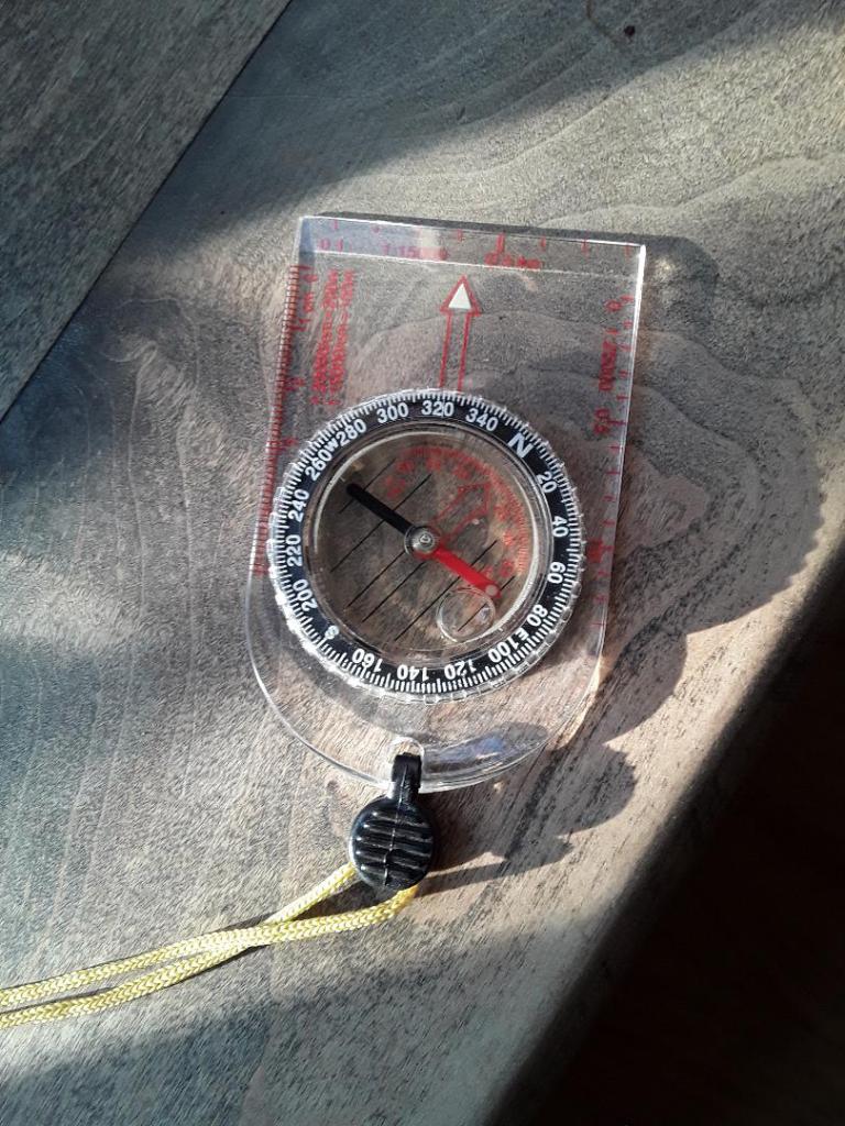
We have a compass and a map. See image below.

Above is a cheap, crude compass and a common road map. You can see the scale bar and the “north seeking arrow.” Note that the north arrow is roughly aligned with the compass. This is important.
Why. Because now you and the map are pointed in the same direction. Your body faces north, left is west, east is right, and behind you is south.
The pictured compass is crude and cheap. It is also surprisingly accurate, and is probably better than what the Spaniards used to navigate the globe. You can get from one town to another with such a device, look at the map. If you need to walk southwest to get there, turn your body until the compass, held flat, is pointing southwest. Look up. Find something in that direction. Walk towards it. When you get there, take another “sighting,” and continue walking. Repeat over and over until you get where you’re going.
This is where I must mention that I’m leaving a lot out.
For example, there is a thing called “magnetic declination” that throws off a compasses’ accuracy.
Here’s my take on that. If it’s less than ten degrees, and you are traveling short “legs,” don’t worry about it.
If it’s over ten degrees where you are (Google it), then read up on how to compensate for it. Not really hard. For example, here in Ohio it is 8 west. This means that for a true reading you need to add 8 degrees to what your compass says for accuracy. For east declinations, you subtract.
Also, it is helpful to know how far you must travel and approximately how far you have covered.
How do you know how far to go?
See image above. All maps have a “scale bar” that allows you to plot approximately the distance on a map. Mind you, this is “as the crow flies” distance, and not what you will actually travel because of terrain and obstacles.
Maybe go down to a football pitch and measure off your “pace count.” This is easy to do. Start at one end, step off taking normal steps. Count every time your left foot hits the ground. My walking pace count is 62/100M.
And like everything else, this has a caveat, too. Your pace count changes if you run, go uphill, etc. So just do like I do and keep it simple; use the walking count on average.
An example. Using the scale bar on the map, you know you have to walk southwest about five miles. Convert to kilometers right away, or you are in hell. So 1 mile= 1.5km. 5 mile=7.5 km. 620 paces per km. Start walking. After an hour and a half, you should be pretty close unless you had to swim a river or something else stupid (been there, done that).
A practical example with the cheap compass.
Alright, you have oriented your map to the north, you and your map are pointed in the cardinal directions. You want to move from Summitville to Augusta. Using your handy scale bar and guesstimating, you see it’s about eight miles away cross-country. Looking at the compass, you can tell you need to go almost due west. Close your map, turn until your compass and your body are facing west, and start to move.
Make sure that you periodically check that you are in fact moving west. When you hit a road about 12km later, look for signs. If it is Route 9, good. You will be fairly close to Augusta.
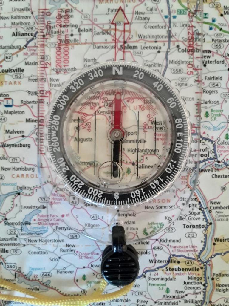
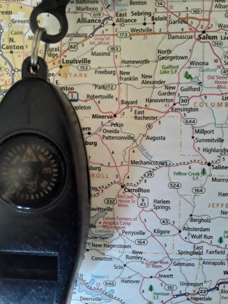
If you spend just a few dollars more, you are capable of much more precision. The compass above has a ton of good features, but not so many that it overwhelms. Also, note that it is partially luminescent. Handy if you need to move at night.
Once again, we want to move from Summitville to Augusta. Using the scale bar and the ruler, we can do a better estimate of our traveling distance. Also, instead of an approximate heading, we can nail this one down to degrees. See how the compass is centered over Summitville? Look right and you will see Augusta. 268 degrees, map heading.
You could go ahead and add your 8 degrees here for the declination, which would give you an adjusted true heading of 276. This would be accurate and would potentially land you in the center of Augusta.
But I said don’t bother with that. So move out at 270ish degrees, you’ll be close enough for rough work.
After all, we aren’t calling in artillery.
And buddy, I sure am glad!
There you go, rough and dirty. This is how to use a compass. Just make sure it’s roughly flat when you take a sighting and check your heading early and often.
Piece of cake.
Now go spend your five bucks and put the compass away somewhere. Forget about it. And when your car is broke down by the road, cell reception is lousy, and you need to get to the next town, you’ll remember.
There’s a compass in my glovebox, and I know how to use it.

A the Silva compass – great piece of kit, easier than the old issued Big Brass Prismatic compass and no need for a protractor on the map. Most of the time I’d be going map to ground unless in tight country when more specific bearings are required (if that makes sense). Incidentally, I still find myself thinking in mils rather than degrees….thanks Army! (6400 mils in a circle as opposed to 360 degrees for other readers!).
LikeLike
The Silva style compass is pretty awesome, although I am still fond of my old Sandy 183.
LikeLike
I had no idea how to use a compass like that. Very enlightening. There used to be a company that made compasses near my house. Their slogan was my favourite. XXX compass, get one or get lost.
LikeLike
Ah! So I have benefitted at least one reader. Excellent..
LikeLike
The magical moment when you turn to the pace counter in the section … give the signal for paces. He looks at you blankly.
LikeLike
Ha! Yeah, totally! Always have a back up counter! And an extra map.
LikeLike
Although you can turn to that dig and he gives you the same look
LikeLike
Especially when you’ve been out for a couple of weeks and you’re headed to the exfil point.
LikeLike
You really brought out the chuckles… nothing like doing this in the dark and you fall off a small cliff into a swampy oxbow (billabong)!
LikeLike